
As the reviews and specifications say, this is probably the most advanced hand held gps unit. H in the name designates new high sensitivity gps sensor which can locate the unit inside thick forests and even houses. The latter promise may seem as an exaggeration but believe me, it isn't. C probably designates units with cartography. x probably designates top models. In any case this model can only be matched by Garmin GPSmap 76CSx. But they are marketed to different segments. eTrex is for general outdoor use, while gpsmap is for nautic purposes. The only differences are this: nautic version is larger, heavier, considerably more expensive, has more buttons, floats on water and some software details are different. But generally I rather prefer much smaller size and lighter weight of etrex series to the gpsmap series. One more thing there is to differentiate this model from other etrex models. Lets start from the cheapest cartography etrex models with H designation (in the brackets there are major differences):
1. eTrex Venture HC (cartography, 24MB internal memory, no expansion slot, 14h battery autonomy)
2. eTrex Summit HC (all from venture+ barometric altimeter+electronic compass)
3. eTrex Legend HCx (no barometric altimeter, electronic compass, nor special internal memory but has microSD expansion slot, 25h battery autonomy and turn-by-turn navigation)
4. eTrex Vista HCx (this unit) (all from legend+barometric altimeter+electronic compass)
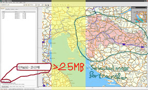
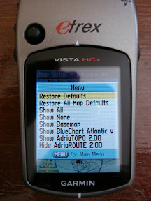
I was thinking about buying Venture model but later we went with Vista. And looking back now we made a great choice. But why? The only difference is with external memory slot, two times the battery life and no navigation. Is it really worth 30% greater price? Simply put: yes. But not because of the battery life nor navigation (well that is handy if you are traveling alone on some place you have never been). It is about memory. As I found out after buying this unit, 25MB to put maps in is not even remotely enough. As you can see on the next image that I only selected a small geographic area (half of my country though but it is not big anyway) of AdriaROUTE map and it is already 29MB. Then if you have TOPO map or BlueChart you can only put extremely small parts of the map. The units with 25MB of internal memory (venture and summit) are therefore completely unusable which is a shame because memory is cheap nowadays and it seems to me that those units are artificially crippled with this memory limitation.
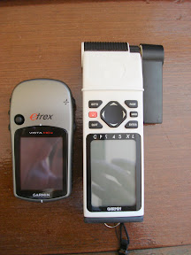
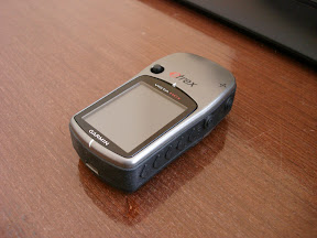
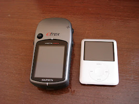
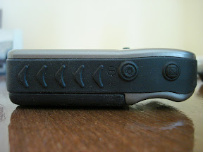
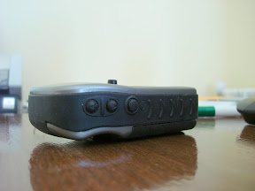
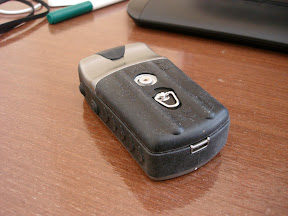
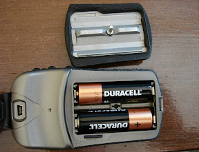
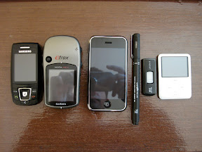
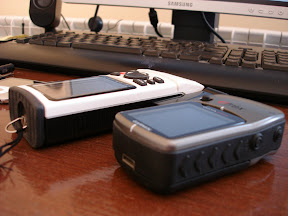
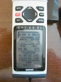
As you can see the size of the unit went a long way from the 10y+ old models like Garmin 45. The unit feels solid in ones hand, it is quite rugged and has no moving or extending parts. Batteries are hidden behind a metal cover which itself is covered in rubber. I have a slight gripe with that rubber because as you can see on the pictures it dust just loves to stick to it. Specifications say that the unit is IPX7 conforming which means that it could be immersed in 1m of water for 30 minutes. I'm actually not sure that the unit would be functioning great afterwards because usb rubber "plug" is not really sturdy nor especially sealing on a quick glance. Buttons are a bit hard, but not too hard. One thing though is I don't like is left hand operation. As you can see, the joystick is placed on the left side of the unit so it is awkward to use it with right hand. I don't understand what important thing you would do with your right hand while walking and doing something with your left hand on the gps unit. This is my only serious complain on the ergonomy of the unit even though I'm pretty much ambidextreous.
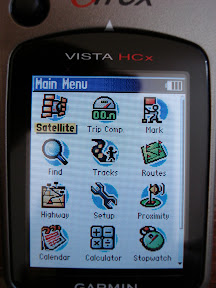
Software is very good but it could be better designed. So lets get a quick rundown of major things.
- great map detail (sometimes even too great, but can be easly reduced)
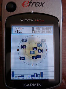
- extremely high precision (+-3m). You have a blue circle which represents visual precision (there is also numeric exact precision which is affected by satellite signal strength.
- works inside buildings/bags/pockets extremely well.
- fast satelite search and lock-on. Hot start: 3s, warm start: 33s, cold start: 39s.
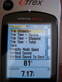
- almost all software screens are configurable.
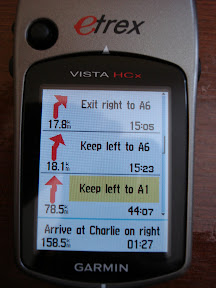
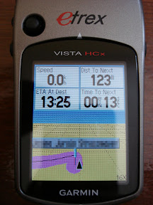
- route (re)calculation is fast and unobtrusive. Routing is great and when you get to some big intersection the unit zooms the map so you can see what lane you should take.
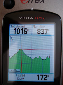
- altimeter is great and when you click on some point of the graph it will take you to the exact place in the map you were at that time/altitude.
- electronic compass is useful when you are still or moving slowly because it will always rotate the map in the direction you are holding your gps unit. This of course can be disabled. You can also configure at what speed the unit will use electronic compass or gps compass. I'm not actually sure in electronic compass precision (it says +- 3deg which isn't too little) but I still need to research it.
- Adding new waypoints is fast and easy. Searching for some map items (gas stations, marine services, restaurants or anything else) is very easy. Maps are much more detailed than google maps. I was sometimes pleasantly surprised when I found out some map locations I thought are not that important to include in a map.
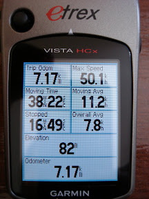
- Batteries actually do last 25h at least.
- Backlight has many levels of intensity.
- There is a lot of other settings including modes for parachutists, gliders etc.
- The unit cannot display all maps you have installed at the same time at the top of each other. So you have to select the map you want so use at the time. But this is done relatively easy and practically there is no need to have bluechart and route map at the same time displayed.
- It is very easy to copy the maps/waypoints/routes etc. from the MapSource application to the gps unit. And vice versa.
- Some menues are not logically positioned but that is not a big problem.
All in all, I'm very pleased with the unit and was quite surprised how the unit is performing in general. If you are thinking of buying it, I can guarantee you will be satisfied if you buy it.
No comments:
Post a Comment